Accueil Foire Aux Questions Trouver d'autres membres Rechercher Utilisez le vBpad pour stocker des notes personnelles Ici, vous pouvez voir les sujets auxquels vous avez souscris, vos messages privés; et modifier vos informations personnelles et préférences. Statistiques du forum Enregistrez vous gratuitement ! Se déconnecter  
Forum OXMO Forum OXMO > Section Généraliste > Discussion Libre > Je vous parle en direct de Mars (Opportunity a atterri !)


Aller au Forum:
Notez ce sujet :

Page(s) (49): [ <<   <   33   34   35   36   37   38   39   40   41   42   43   44   45   46   47   48   49   > ]   Sujet précédent   Sujet suivant
Auteur
Sujet Poster un nouveau sujet    Poster une réponse
 Seth  Rechercher tous les messages de ce membre Cliquez ici pour envoyer un message privé à cet utilisateur
Confirmé

Déconnecté

Niveau : 3
N° de Membre : 1512

Ancienneté : 100%
Participation : 2%
Inscription: 07 May 2002
Localisation:
Messages: 1390
Sujets Lancés : 70


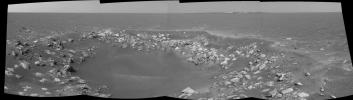
http://photojournal.jpl.nasa.gov/jp...5782_modest.jpg
PIA05782.tif (2.864 MB) http://photojournal.jpl.nasa.gov/tiff/PIA05782.tif

Citation:
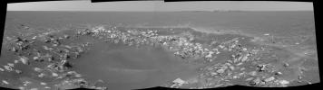
This cylindrical projection was constructed from a sequence of four images taken by the navigation camera onboard the Mars Exploration Rover Opportunity.

The images were acquired on sol 85 of Opportunity's mission to Meridiani Planum. The camera acquired the images at approximately 14:28 local solar time, or around 6:30 a.m. Pacific Daylight Time, on April 20, 2004.

The view is from the rover's new location, a region dubbed "Fram Crater" located some 450 meters (.3 miles) from "Eagle Crater" and roughly 250 meters (820 feet) from "Endurance Crater" (upper right).


Signaler ce message à un modérateur | IP: Logguée
Temps en ligne : 8 Jours, 15 Heures, 44 Minutes, 21 Secondes en ligne

Old Post 26-04-2004 15:17
Cliquez ici pour voir le profil de Seth Cliquez ici pour lui envoyer un message privé  Trouver plus de messages de Seth Ajouter Seth à votre liste d'amis Editer/Effacer le Message Citer le message dans la réponse
 Seth  Rechercher tous les messages de ce membre Cliquez ici pour envoyer un message privé à cet utilisateur
Confirmé

Déconnecté

Niveau : 3
N° de Membre : 1512

Ancienneté : 100%
Participation : 2%
Inscription: 07 May 2002
Localisation:
Messages: 1390
Sujets Lancés : 70


http://photojournal.jpl.nasa.gov/jp...5783_modest.jpg
PIA05783.tif (8.032 MB) http://photojournal.jpl.nasa.gov/tiff/PIA05783.tif

Citation:
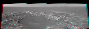
This 3-D cylindrical-perspective projection was constructed from a sequence of four images taken by the navigation camera onboard the Mars Exploration Rover Opportunity.

The images were acquired on sol 85 of Opportunity's mission to Meridiani Planum. The camera acquired the images at approximately 14:28 local solar time, or around 6:30 a.m. Pacific Daylight Time, on April 20, 2004.

The view is from the rover's new location, a region dubbed "Fram Crater" located some 450 meters (.3 miles) from "Eagle Crater" and roughly 250 meters (820 feet) from "Endurance Crater" (upper right).


Signaler ce message à un modérateur | IP: Logguée
Temps en ligne : 8 Jours, 15 Heures, 44 Minutes, 21 Secondes en ligne

Old Post 26-04-2004 15:18
Cliquez ici pour voir le profil de Seth Cliquez ici pour lui envoyer un message privé  Trouver plus de messages de Seth Ajouter Seth à votre liste d'amis Editer/Effacer le Message Citer le message dans la réponse
 Seth  Rechercher tous les messages de ce membre Cliquez ici pour envoyer un message privé à cet utilisateur
Confirmé

Déconnecté

Niveau : 3
N° de Membre : 1512

Ancienneté : 100%
Participation : 2%
Inscription: 07 May 2002
Localisation:
Messages: 1390
Sujets Lancés : 70


http://photojournal.jpl.nasa.gov/jp...5784_modest.jpg
PIA05784.tif (3.039 MB) http://photojournal.jpl.nasa.gov/tiff/PIA05784.tif

Citation:
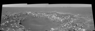
This cylindrical-perspective projection was constructed from a sequence of four images taken by the navigation camera onboard the Mars Exploration Rover Opportunity. It was taken with the camera's left eye.

The images were acquired on sol 85 of Opportunity's mission to Meridiani Planum. The camera acquired the images at approximately 14:28 local solar time, or around 6:30 a.m. Pacific Daylight Time, on April 20, 2004.

The view is from the rover's new location, a region dubbed "Fram Crater" located some 450 meters (.3 miles) from "Eagle Crater" and roughly 250 meters (820 feet) from "Endurance Crater" (upper right).


Signaler ce message à un modérateur | IP: Logguée
Temps en ligne : 8 Jours, 15 Heures, 44 Minutes, 21 Secondes en ligne

Old Post 26-04-2004 15:19
Cliquez ici pour voir le profil de Seth Cliquez ici pour lui envoyer un message privé  Trouver plus de messages de Seth Ajouter Seth à votre liste d'amis Editer/Effacer le Message Citer le message dans la réponse
 Seth  Rechercher tous les messages de ce membre Cliquez ici pour envoyer un message privé à cet utilisateur
Confirmé

Déconnecté

Niveau : 3
N° de Membre : 1512

Ancienneté : 100%
Participation : 2%
Inscription: 07 May 2002
Localisation:
Messages: 1390
Sujets Lancés : 70


http://photojournal.jpl.nasa.gov/jp...5785_modest.jpg
PIA05785.tif (2.744 MB) http://photojournal.jpl.nasa.gov/tiff/PIA05785.tif

Citation:
This cylindrical-perspective projection was constructed from a sequence of four images taken by the navigation camera onboard the Mars Exploration Rover Opportunity. It was taken with the camera's right eye.

The images were acquired on sol 85 of Opportunity's mission to Meridiani Planum. The camera acquired the images at approximately 14:28 local solar time, or around 6:30 a.m. Pacific Daylight Time, on April 20, 2004.

The view is from the rover's new location, a region dubbed "Fram Crater" located some 450 meters (.3 miles) from "Eagle Crater" and roughly 250 meters (820 feet) from "Endurance Crater" (upper right).


Signaler ce message à un modérateur | IP: Logguée
Temps en ligne : 8 Jours, 15 Heures, 44 Minutes, 21 Secondes en ligne

Old Post 26-04-2004 15:20
Cliquez ici pour voir le profil de Seth Cliquez ici pour lui envoyer un message privé  Trouver plus de messages de Seth Ajouter Seth à votre liste d'amis Editer/Effacer le Message Citer le message dans la réponse
 Seth  Rechercher tous les messages de ce membre Cliquez ici pour envoyer un message privé à cet utilisateur
Confirmé

Déconnecté

Niveau : 3
N° de Membre : 1512

Ancienneté : 100%
Participation : 2%
Inscription: 07 May 2002
Localisation:
Messages: 1390
Sujets Lancés : 70

Still missing some, je posterai demain....


Signaler ce message à un modérateur | IP: Logguée
Temps en ligne : 8 Jours, 15 Heures, 44 Minutes, 21 Secondes en ligne

Old Post 26-04-2004 15:20
Cliquez ici pour voir le profil de Seth Cliquez ici pour lui envoyer un message privé  Trouver plus de messages de Seth Ajouter Seth à votre liste d'amis Editer/Effacer le Message Citer le message dans la réponse
 Seth  Rechercher tous les messages de ce membre Cliquez ici pour envoyer un message privé à cet utilisateur
Confirmé

Déconnecté

Niveau : 3
N° de Membre : 1512

Ancienneté : 100%
Participation : 2%
Inscription: 07 May 2002
Localisation:
Messages: 1390
Sujets Lancés : 70


http://photojournal.jpl.nasa.gov/jp...5786_modest.jpg
PIA05786.tif (1.548 MB) http://photojournal.jpl.nasa.gov/tiff/PIA05786.tif

Citation:
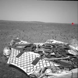
NASA's Mars Exploration Rover Spirit took this navigation camera image on sol 33 (February 5, 2004). In the foreground is the lander, and the untouched surface of Mars lies beyond. Spirit has since traversed across this landscape, and as of the morning of sol 105 (April 19, 2004), sits about 500 meters (1640 feet) away on the horizon (red dot).

The elevated crest on the left side of the image is the rim of "Bonneville" crater, which Spirit reached on sol 65. The rover has since descended from the Bonneville rim and is traveling southeast toward the base of the "Columbia Hills" (not visible in this image).


Signaler ce message à un modérateur | IP: Logguée
Temps en ligne : 8 Jours, 15 Heures, 44 Minutes, 21 Secondes en ligne

Old Post 27-04-2004 00:57
Cliquez ici pour voir le profil de Seth Cliquez ici pour lui envoyer un message privé  Trouver plus de messages de Seth Ajouter Seth à votre liste d'amis Editer/Effacer le Message Citer le message dans la réponse
 Seth  Rechercher tous les messages de ce membre Cliquez ici pour envoyer un message privé à cet utilisateur
Confirmé

Déconnecté

Niveau : 3
N° de Membre : 1512

Ancienneté : 100%
Participation : 2%
Inscription: 07 May 2002
Localisation:
Messages: 1390
Sujets Lancés : 70


http://photojournal.jpl.nasa.gov/jp...5796_modest.jpg
PIA05796.tif (678.3 kB) http://photojournal.jpl.nasa.gov/tiff/PIA05796.tif

Citation:
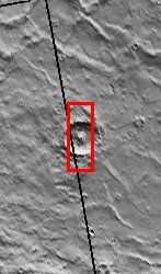
22 April 2004
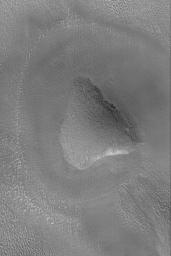
This Mars Global Surveyor (MGS) Mars Orbiter Camera (MOC) picture shows a rounded knob in the Propontis region of Mars near 43.1°N, 182.3°W. Dark dots on the hilltop and slopes are house-sized (and larger) boulders. The picture covers an area about 3 km (1.9 mi) across. Sunlight illuminates the scene from the lower left.


Signaler ce message à un modérateur | IP: Logguée
Temps en ligne : 8 Jours, 15 Heures, 44 Minutes, 21 Secondes en ligne

Old Post 27-04-2004 00:58
Cliquez ici pour voir le profil de Seth Cliquez ici pour lui envoyer un message privé  Trouver plus de messages de Seth Ajouter Seth à votre liste d'amis Editer/Effacer le Message Citer le message dans la réponse
 Seth  Rechercher tous les messages de ce membre Cliquez ici pour envoyer un message privé à cet utilisateur
Confirmé

Déconnecté

Niveau : 3
N° de Membre : 1512

Ancienneté : 100%
Participation : 2%
Inscription: 07 May 2002
Localisation:
Messages: 1390
Sujets Lancés : 70


http://photojournal.jpl.nasa.gov/jp...5801_modest.jpg
PIA05801.tif (2.707 MB) http://photojournal.jpl.nasa.gov/tiff/PIA05801.tif


Citation:

Released 22 April 2004

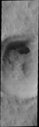
Our group is from Saratoga Springs, NY and is called the Saratoga Springs NASA Club. It contains approximately 30 students between 9th and 12th grade who have been participating since September of 2001. We also worked with a small group of students from Chekhov, Russia in order to do a joint MSIP project. Chekhov is the sister city of Saratoga Springs. Their group contains kids of the same age group as our NASA Club. Our group, along with a few students from the Chekhov branch, visited Arizona State University in November of 2003.

The image we targeted is in the Southern Hemisphere and is at -67 degrees N.

We chose this area because of the presence of craters in the vicinity, which we hope will help with our thesis about the presence of craters that contain lobates as use for evidence that there might once have been water in this area.

This image is causing us considerable difficulty due to the presence of a structure that resembles a lake located in the center of the crater.

Image information: VIS instrument. Latitude -67.1, Longitude 55.3 East (304.7 West). 19 meter/pixel resolution.

NASA and Arizona State University™s Mars Education Program is offering students nationwide the opportunity to be involved in authentic Mars research by participating in the Mars Student Imaging Project (MSIP). Teams of students in grades 5 through college sophomore level have the opportunity to work with scientists, mission planners and educators on the THEMIS team at ASU™s Mars Space Flight Facility, to image a site on Mars using the THEMIS visible wavelength camera. For more information go to the MSIP website: http://msip.asu.edu.

Note: this THEMIS visual image has not been radiometrically nor geometrically calibrated for this preliminary release. An empirical correction has been performed to remove instrumental effects. A linear shift has been applied in the cross-track and down-track direction to approximate spacecraft and planetary motion. Fully calibrated and geometrically projected images will be released through the Planetary Data System in accordance with Project policies at a later time.

NASA's Jet Propulsion Laboratory manages the 2001 Mars Odyssey mission for NASA's Office of Space Science, Washington, D.C. The Thermal Emission Imaging System (THEMIS) was developed by Arizona State University, Tempe, in collaboration with Raytheon Santa Barbara Remote Sensing. The THEMIS investigation is led by Dr. Philip Christensen at Arizona State University. Lockheed Martin Astronautics, Denver, is the prime contractor for the Odyssey project, and developed and built the orbiter. Mission operations are conducted jointly from Lockheed Martin and from JPL, a division of the California Institute of Technology in Pasadena.


Signaler ce message à un modérateur | IP: Logguée
Temps en ligne : 8 Jours, 15 Heures, 44 Minutes, 21 Secondes en ligne

Old Post 27-04-2004 00:59
Cliquez ici pour voir le profil de Seth Cliquez ici pour lui envoyer un message privé  Trouver plus de messages de Seth Ajouter Seth à votre liste d'amis Editer/Effacer le Message Citer le message dans la réponse
 Seth  Rechercher tous les messages de ce membre Cliquez ici pour envoyer un message privé à cet utilisateur
Confirmé

Déconnecté

Niveau : 3
N° de Membre : 1512

Ancienneté : 100%
Participation : 2%
Inscription: 07 May 2002
Localisation:
Messages: 1390
Sujets Lancés : 70


http://photojournal.jpl.nasa.gov/jp...5787_modest.jpg
PIA05787.tif (664.1 kB) http://photojournal.jpl.nasa.gov/tiff/PIA05787.tif

Citation:
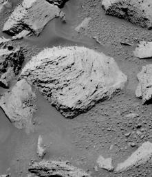
The Mars Exploration Rover Opportunity broke its own record for the deepest hole ground into a rock on another planet with a 7.2-millimeter (about 0.28-inch) grind on the rock "Pilbara," on the rover's 86th sol on Mars.


This image is from the rover's panoramic camera and features Pilbara before the rover ground into it with its rock abrasion tool. After careful examination of the rock, the rock abrasion tool engineers determined that the upper left portion (visible in this image) of Pilbara was the safest area to grind. The now familiar "blueberries," or spherules, are present in this rock, however, they do not appear in the same manner as other berries examined during this mission. Reminiscent of a golf tee, the blueberries sit atop a "stem," thus making them even more of an obstacle through which to grind. The left side of the rock is relatively berry-free and proved to be an ideal spot for the procedure.


The team has developed a new approach to commanding the rock abrasion tool that allows for more aggressive grinding parameters. The tool is now programmed, in the event of a stall, to retreat from its target and attempt to grind again. This allows the grinder to essentially reset itself instead of aborting its sequence altogether and waiting for further commands from rover planners.


Signaler ce message à un modérateur | IP: Logguée
Temps en ligne : 8 Jours, 15 Heures, 44 Minutes, 21 Secondes en ligne

Old Post 27-04-2004 01:00
Cliquez ici pour voir le profil de Seth Cliquez ici pour lui envoyer un message privé  Trouver plus de messages de Seth Ajouter Seth à votre liste d'amis Editer/Effacer le Message Citer le message dans la réponse
 Seth  Rechercher tous les messages de ce membre Cliquez ici pour envoyer un message privé à cet utilisateur
Confirmé

Déconnecté

Niveau : 3
N° de Membre : 1512

Ancienneté : 100%
Participation : 2%
Inscription: 07 May 2002
Localisation:
Messages: 1390
Sujets Lancés : 70


http://photojournal.jpl.nasa.gov/jp...5788_modest.jpg
PIA05788.tif (403.9 kB) http://photojournal.jpl.nasa.gov/tiff/PIA05788.tif

Citation:
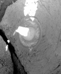
The Mars Exploration Rover Opportunity broke its own record for the deepest hole ground into a rock on another planet with a 7.2-millimeter (about 0.28-inch) grind on the rock "Pilbara," on the rover's 86th sol on Mars.


This image is a panoramic camera picture highlighting the hole left by the rock abrasion tool after two hours and 16 minutes of grinding. The hole is 7.2 millimeters (about 0.28 inches) deep and 4.5 centimeters (about 1.8 inches) in diameter. The tool swept the hole clean after grinding, leaving the ring of cuttings around the hole. When this image was taken, the abraded area was mostly shaded by the rover, with the sun peeking through the joint that connects the front solar panel to the body of the rover.


The team has developed a new approach to commanding the rock abrasion tool that allows for more aggressive grinding parameters. The tool is now programmed, in the event of a stall, to retreat from its target and attempt to grind again. This allows the grinder to essentially reset itself instead of aborting its sequence altogether and waiting for further commands from rover planners.


Signaler ce message à un modérateur | IP: Logguée
Temps en ligne : 8 Jours, 15 Heures, 44 Minutes, 21 Secondes en ligne

Old Post 27-04-2004 01:01
Cliquez ici pour voir le profil de Seth Cliquez ici pour lui envoyer un message privé  Trouver plus de messages de Seth Ajouter Seth à votre liste d'amis Editer/Effacer le Message Citer le message dans la réponse
 Seth  Rechercher tous les messages de ce membre Cliquez ici pour envoyer un message privé à cet utilisateur
Confirmé

Déconnecté

Niveau : 3
N° de Membre : 1512

Ancienneté : 100%
Participation : 2%
Inscription: 07 May 2002
Localisation:
Messages: 1390
Sujets Lancés : 70


http://photojournal.jpl.nasa.gov/jp...5789_modest.jpg
PIA05789.tif (846.3 kB) http://photojournal.jpl.nasa.gov/tiff/PIA05789.tif

Citation:
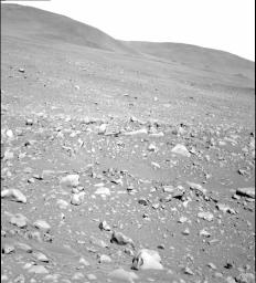
NASA's Mars Exploration Rover Spirit took this gray-scale panoramic camera image of the "Columbia Hills" on sol 107 (April 21, 2004). Spirit is still approximately 2 kilometers (1.2 miles) and 52 sols away from its destination at the western base of the hills.

Once Spirit reaches the base, scientists and rover controllers will re-analyze the terrain and determine whether to send the rover up the mountain. Another option will be to send Spirit south along the base where she may encounter outcrops as indicated by orbital images from the Mars Orbiter Camera on the Mars Global Surveyor spacecraft.


Signaler ce message à un modérateur | IP: Logguée
Temps en ligne : 8 Jours, 15 Heures, 44 Minutes, 21 Secondes en ligne

Old Post 27-04-2004 01:02
Cliquez ici pour voir le profil de Seth Cliquez ici pour lui envoyer un message privé  Trouver plus de messages de Seth Ajouter Seth à votre liste d'amis Editer/Effacer le Message Citer le message dans la réponse
 Seth  Rechercher tous les messages de ce membre Cliquez ici pour envoyer un message privé à cet utilisateur
Confirmé

Déconnecté

Niveau : 3
N° de Membre : 1512

Ancienneté : 100%
Participation : 2%
Inscription: 07 May 2002
Localisation:
Messages: 1390
Sujets Lancés : 70


http://photojournal.jpl.nasa.gov/jp...5802_modest.jpg
PIA05802.tif (680 kB) http://photojournal.jpl.nasa.gov/tiff/PIA05802.tif

Citation:
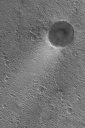
23 April 2004
Thin deposits of bright dust often form tails in the lee of craters in Acidalia Planitia. This Mars Global Surveyor (MGS) Mars Orbiter Camera (MOC) picture shows an example from southern Acidalia near 23.0°N, 39.6°W. The dominant winds blow from the upper right (northeast) toward the lower left (southwest). The picture covers an area about 3 km (1.9 mi) across. Sunlight illuminates the scene from the lower left.


Signaler ce message à un modérateur | IP: Logguée
Temps en ligne : 8 Jours, 15 Heures, 44 Minutes, 21 Secondes en ligne

Old Post 27-04-2004 01:03
Cliquez ici pour voir le profil de Seth Cliquez ici pour lui envoyer un message privé  Trouver plus de messages de Seth Ajouter Seth à votre liste d'amis Editer/Effacer le Message Citer le message dans la réponse
 Seth  Rechercher tous les messages de ce membre Cliquez ici pour envoyer un message privé à cet utilisateur
Confirmé

Déconnecté

Niveau : 3
N° de Membre : 1512

Ancienneté : 100%
Participation : 2%
Inscription: 07 May 2002
Localisation:
Messages: 1390
Sujets Lancés : 70


http://photojournal.jpl.nasa.gov/jp...5803_modest.jpg
PIA05803.tif (3.298 MB) http://photojournal.jpl.nasa.gov/tiff/PIA05803.tif


Citation:
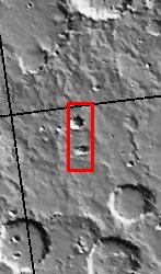
Released 23 April 2004

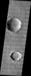
The image you see before you was taken in the Noachis Terra Region in the Southern hemisphere of Mars. The two most prominent features in this photo are the relatively large impact craters, one located towards the top of the image, and one located in the lower area. This image was chosen for this particular MSIP project because the area was in a rocky region that was in located within latitudes known to have gully formations in the walls of local craters. Therefore, the craters appeared to be likely candidates to try and determine if gully formation in crater walls are more likely to form on the pole or equator-facing wall of the crater.

Our team, from the Klein High School Astronomy Club, included four students--two sophomores, a junior, and a senior, plus our club astronomer/teacher, and our sponsor. As part of the astronomy club, the team is all volunteer, and is involved in other astronomical activities in the community. We are from Klein, Texas, which is a suburb of Houston, Texas.

Three returning team members are participating in our MSIP project again this year.

Image information: VIS instrument. Latitude -30.5, Longitude 356.1 East (3.9 West). 19 meter/pixel resolution.

NASA and Arizona State University™s Mars Education Program is offering students nationwide the opportunity to be involved in authentic Mars research by participating in the Mars Student Imaging Project (MSIP). Teams of students in grades 5 through college sophomore level have the opportunity to work with scientists, mission planners and educators on the THEMIS team at ASU™s Mars Space Flight Facility, to image a site on Mars using the THEMIS visible wavelength camera. For more information go to the MSIP website: http://msip.asu.edu.

Note: this THEMIS visual image has not been radiometrically nor geometrically calibrated for this preliminary release. An empirical correction has been performed to remove instrumental effects. A linear shift has been applied in the cross-track and down-track direction to approximate spacecraft and planetary motion. Fully calibrated and geometrically projected images will be released through the Planetary Data System in accordance with Project policies at a later time.

NASA's Jet Propulsion Laboratory manages the 2001 Mars Odyssey mission for NASA's Office of Space Science, Washington, D.C. The Thermal Emission Imaging System (THEMIS) was developed by Arizona State University, Tempe, in collaboration with Raytheon Santa Barbara Remote Sensing. The THEMIS investigation is led by Dr. Philip Christensen at Arizona State University. Lockheed Martin Astronautics, Denver, is the prime contractor for the Odyssey project, and developed and built the orbiter. Mission operations are conducted jointly from Lockheed Martin and from JPL, a division of the California Institute of Technology in Pasadena.


Signaler ce message à un modérateur | IP: Logguée
Temps en ligne : 8 Jours, 15 Heures, 44 Minutes, 21 Secondes en ligne

Old Post 27-04-2004 01:05
Cliquez ici pour voir le profil de Seth Cliquez ici pour lui envoyer un message privé  Trouver plus de messages de Seth Ajouter Seth à votre liste d'amis Editer/Effacer le Message Citer le message dans la réponse
 Seth  Rechercher tous les messages de ce membre Cliquez ici pour envoyer un message privé à cet utilisateur
Confirmé

Déconnecté

Niveau : 3
N° de Membre : 1512

Ancienneté : 100%
Participation : 2%
Inscription: 07 May 2002
Localisation:
Messages: 1390
Sujets Lancés : 70


http://photojournal.jpl.nasa.gov/jp...5805_modest.jpg
PIA05805.tif (623.5 kB) http://photojournal.jpl.nasa.gov/tiff/PIA05805.tif

Citation:
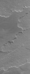
24 April 2004
This Mars Global Surveyor (MGS) Mars Orbiter Camera (MOC) picture shows details on large lava flows in the Tharsis volcanic region of Mars. The image is located near 25.4°N, 123.7°W. The picture covers an area about 3 km (1.9 mi) across. Sunlight illuminates the scene from the lower left.


Signaler ce message à un modérateur | IP: Logguée
Temps en ligne : 8 Jours, 15 Heures, 44 Minutes, 21 Secondes en ligne

Old Post 27-04-2004 01:06
Cliquez ici pour voir le profil de Seth Cliquez ici pour lui envoyer un message privé  Trouver plus de messages de Seth Ajouter Seth à votre liste d'amis Editer/Effacer le Message Citer le message dans la réponse
 Seth  Rechercher tous les messages de ce membre Cliquez ici pour envoyer un message privé à cet utilisateur
Confirmé

Déconnecté

Niveau : 3
N° de Membre : 1512

Ancienneté : 100%
Participation : 2%
Inscription: 07 May 2002
Localisation:
Messages: 1390
Sujets Lancés : 70


http://photojournal.jpl.nasa.gov/jp...5806_modest.jpg
PIA05806.tif (5.815 MB) http://photojournal.jpl.nasa.gov/tiff/PIA05806.tif

Citation:
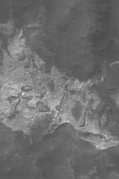
25 April 2004
This Mars Global Surveyor (MGS) Mars Orbiter Camera (MOC) image shows light-toned, somewhat layered rock outcrops on the north wall of Columbus Crater, located near 28.7°S, 166.3°W. This material is a remnant of a formerly more extensive light-toned unit that extended across the floor of Columbus. Today, remnants are found all around the walls of the crater, and at least one small remnant has been spotted on the crater floor. The picture covers an area about 3 km (1.9 mi) across. Sunlight illuminates the scene from the upper left.


Signaler ce message à un modérateur | IP: Logguée
Temps en ligne : 8 Jours, 15 Heures, 44 Minutes, 21 Secondes en ligne

Old Post 27-04-2004 01:08
Cliquez ici pour voir le profil de Seth Cliquez ici pour lui envoyer un message privé  Trouver plus de messages de Seth Ajouter Seth à votre liste d'amis Editer/Effacer le Message Citer le message dans la réponse
Il est actuellement 10:02 (GMT) Poster un nouveau sujet    Poster une réponse   
Page(s) (49): [ <<   <   33   34   35   36   37   38   39   40   41   42   43   44   45   46   47   48   49   > ]  Sujet précédent   Sujet suivant
Forum OXMO > Section Généraliste > Discussion Libre > Je vous parle en direct de Mars (Opportunity a atterri !)

Aller au Forum:
Notez ce sujet :


 Réponse Rapide
Titre: (Optionnel)
Message:

Convertir automatiquement les URLs Montrer la Signature
Afficher une version imprimable | Envoyer cette page par email | S'inscrire à ce sujet | Télécharger ce sujet
Règles du forum :
Créer de nouveaux sujets
Répondre aux messages
Attacher des fichiers
Editer vos messages
: not autorisé
: not autorisé
: not autorisé
: not autorisé
Le Code HTML est OFF
Le Code vB est ON
Les Smileys sont ONs
Le code [IMG] est ON
 
< Contactez-nous - Forum OXMO>

Uptime du serveur SQL : 2 jour(s) 9 heure(s) et 38 minute(s)
Page générée en 0.015512 secondes en exécutant 42 requêtes SQL.
Apache - Compression GZIP : Activée.